Kolmas sõidupäev oli planeeritud kilomeetritelt kõige lühem umbes 550 km. Alustasime tavapäraselt kell 8. Liikusime mööda väiksemaid teid, mis oli ühest küljest väga huvitav, sest võimaldas näha poolakatest külaelu, samas aga mõjus see negatiivselt meie keskmisele kiirusele. Maapind muutus mägisemaks ja saime ka esimest korda proovida tõusu mööda serpentiine. Ilm oli sõitmiseks väga mõnus, pilvine aga ei sadanud.
The third day of riding was planned to be the shortest in terms of kilometers, about 550 km. We started as usual at 8 o’clock. We traveled along smaller roads, which on one hand was very interesting as it allowed us to see Polish village life, but on the other hand it negatively affected our average speed. The terrain became more mountainous and we got to try climbing serpentine roads for the first time. The weather was very pleasant for riding, cloudy but not raining.
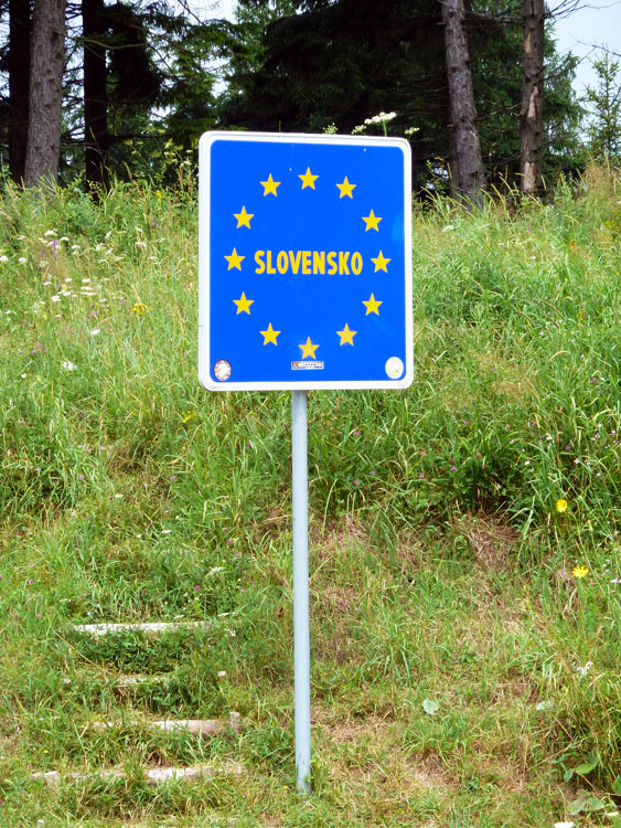
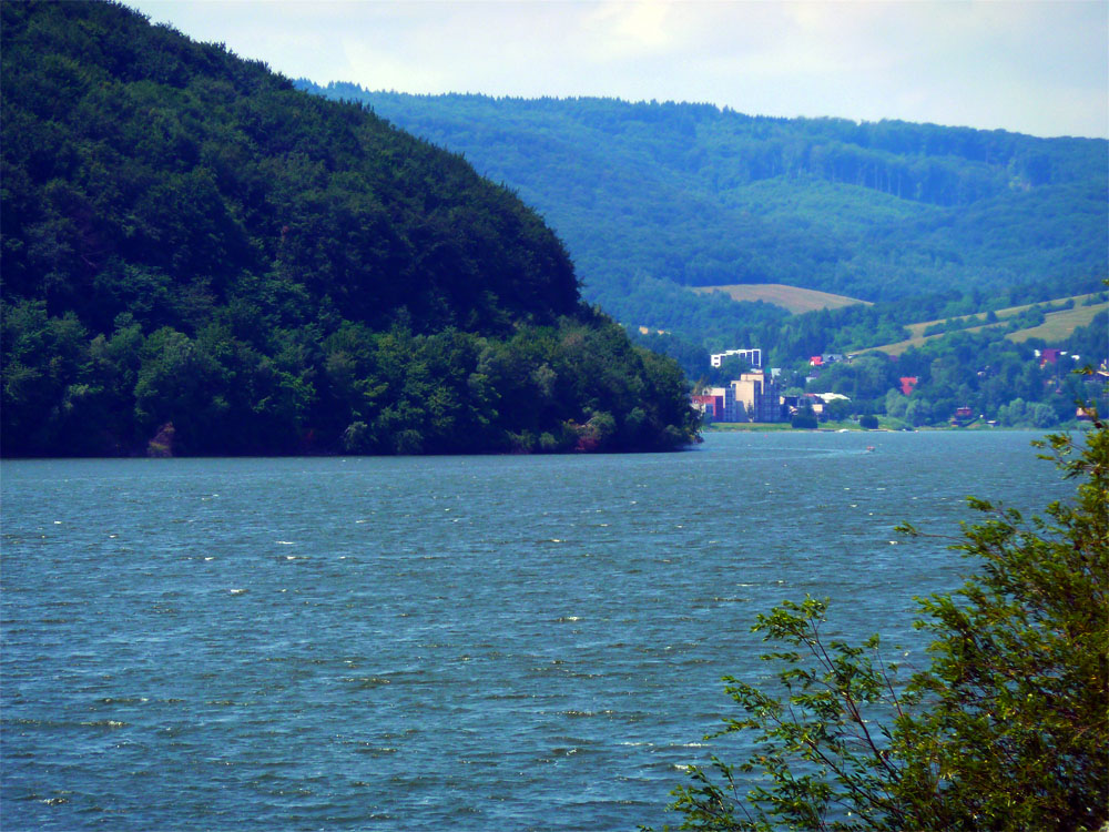
Umbes 150 km pärast jõudsime metsaga kaetud mägedeni, kus asus Slovakkia piir. Piiri tähistas ainult silt, mingit inimtegevust (vähemalt ametlikku), seal ei toimunud. Slovakkia tervitas meid ilusa ilmaga. Teisel pool mäge paistis päike ja temperatuur tõusis kiirelt 30 kraadini. Loodus tundus Slovakkia poolel märksa ilusam kui Poolas.
After about 150 km we reached forested mountains where the Slovak border was located. The border was marked only by a sign, with no human activity (at least official) taking place there. Slovakia greeted us with beautiful weather. On the other side of the mountain the sun was shining and the temperature quickly rose to 30 degrees. Nature seemed much more beautiful on the Slovak side than in Poland.
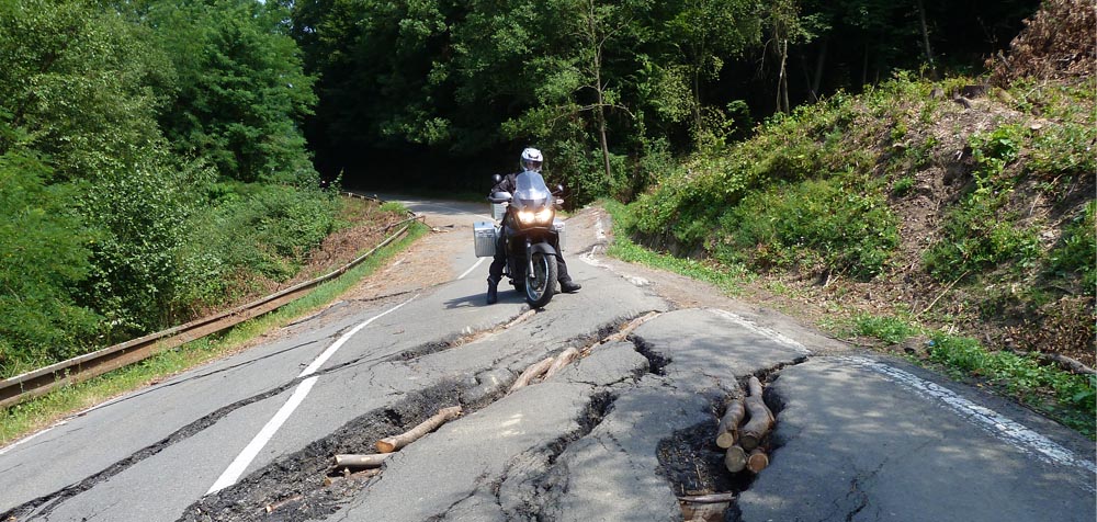
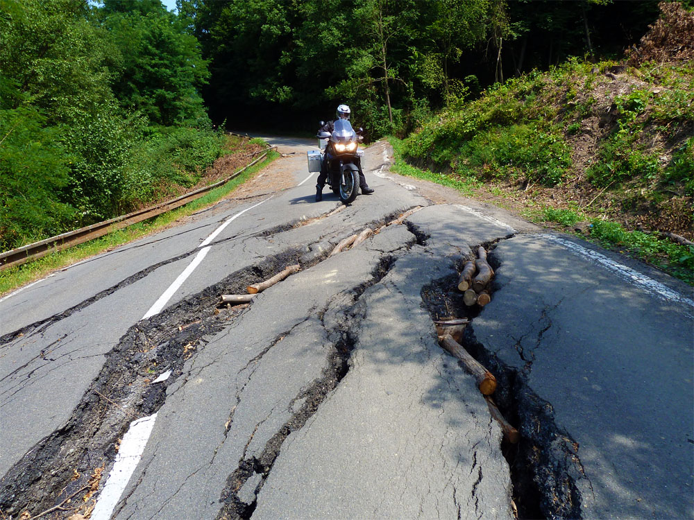
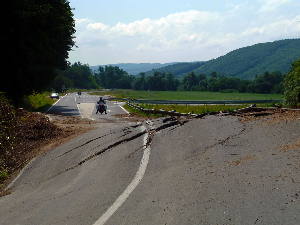
Sõit kulges jälle juba harjunud rütmis – küla läbimine 60 km/h, kahe küla vaheline lõik tavapärases tempos. Ootamatult oli aga keset teed edasisõitmist keelav märk. Polnud tähistatud ka ümbersõitu. Jäime seisma ja ootama kohalikke autojuhte, et vaadata mida nad teevad. Esimene auto pani otse edasi. Teine jäi seisma ja autos olevad noormehed näitasid meile, et võib edasi sõita. Varsti selgus ka märkide põhjus. Vihmast tulenev maalihe oli tee suhteliselt hävitanud. Kuidagi moodi siiski läbi sai ja see õnnestus ka meil.
The ride continued in the now familiar rhythm – passing through villages at 60 km/h, the sections between villages at normal pace. Unexpectedly, however, there was a sign in the middle of the road prohibiting further travel. No detour was marked either. We stopped and waited for local drivers to see what they would do. The first car went straight ahead. The second stopped and the young men in the car showed us that we could continue. Soon the reason for the signs became clear. A rain-caused landslide had relatively destroyed the road. Somehow it was still passable and we managed it too.


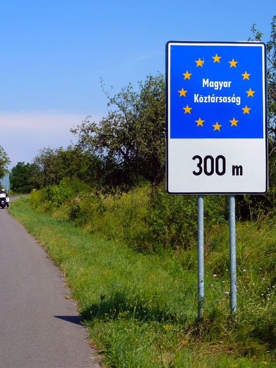
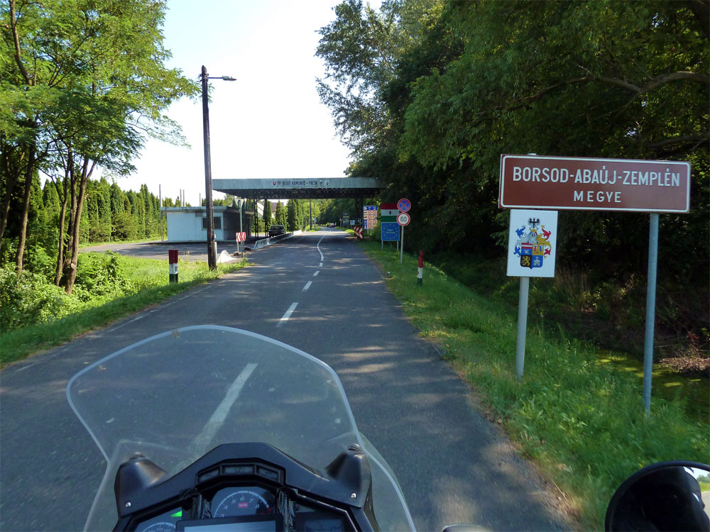
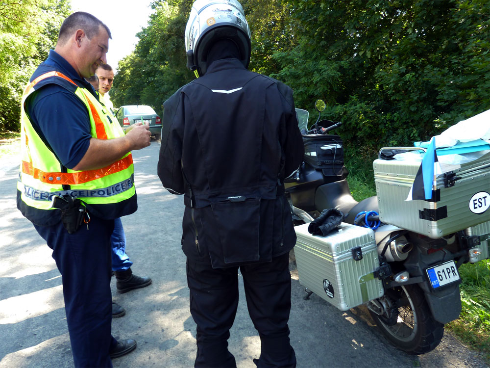
Edasine Slovakkia läbimine kulges ilma vahejuhtumiteta. Kraadiklaas näitas temperatuure üle 30 kraadi ja päike kõrvetas. Sõidurütmi kujundas endiselt külad sage läbimine. Lõpuks jõudsime Ungari piirini, kus meid peatas sõbralik politseinik ja kontrollis dokumente. Tal oli kaasas ka kaks õpilast, kellele ta dokumentide kontrolli ette näitas.
The rest of the journey through Slovakia proceeded without incidents. The thermometer showed temperatures over 30 degrees and the sun was scorching. The riding rhythm was still shaped by frequent passages through villages. Finally we reached the Hungarian border, where a friendly policeman stopped us and checked our documents. He also had two students with him, to whom he was demonstrating the document check.
Arvasime, et Ungari teed on paremad kui Slovakkias, aga Ungari tervitas meid ühe väga konarliku ja aukliku teega. Seda oli küll ainult 8 km ja edaspidi teeolude üle kurta ei saanud. Ungari kohta eredaid mälestusi ei ole. Lõputud külad ja lõõmav päike. Huvitav on see, et näha oli päris erineva nahavärviga inimesi. Mõned olid valged, mõned üsna tumedad. Vaevalt et tegemist oli Aafrika Ungarlastega (või lihtsalt neegritega). Äkki oskab keegi kommenteerida?
We thought Hungarian roads would be better than in Slovakia, but Hungary greeted us with a very bumpy and potholed road. This was only 8 km though, and afterwards we couldn’t complain about the road conditions. There aren’t many vivid memories of Hungary. Endless villages and scorching sun. What’s interesting is that we saw people with quite different skin colors. Some were white, some quite dark. Unlikely that they were African Hungarians (or simply Black people). Perhaps someone can comment?
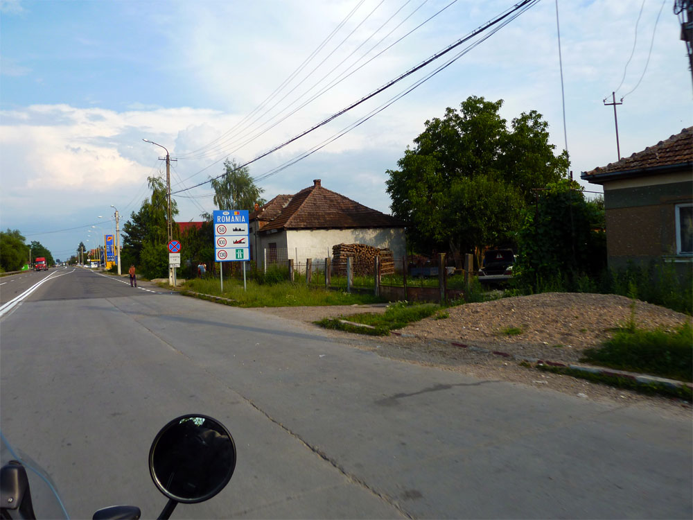
Rumeenias toimus piiripunktis dokumentide kontroll. See käis küll kiirelt ja Inge ei võtnud isegi kiivrit peast. Piiri ületamisega kaotasime siiski ühe tunni, seda mitte ootamise vaid ajavahe tõttu. Rumeenias oli külasid veel rohkem. Vahe eelmiste riikidega on aga see, et kiirust seal eriti maha ei võeta. Tees olid ka esimesed lõõkaugud, mida siiski õnnestus edukalt vältida.
In Romania, documents were checked at the border checkpoint. It went quickly though and Inge didn’t even take her helmet off. However, crossing the border cost us an hour, not due to waiting but due to the time zone difference. Romania had even more villages. The difference from previous countries though is that speed isn’t really reduced there. There were also the first potholes on the road, which we nevertheless managed to avoid successfully.

Helistasime ka oma majutuskohta ja informeerisime neid, et jõuame hiljem. Ilm hakkas minema pilve ja temperatuur muutus mõnusamaks. Kui GPS näitas sihtkohani veel 32 km, keeras tee mägedesse. Ronisime mööda serpentiine üles ja hiljem alla, kokku 20 km. Meie ees oli just läinud vihm, tee veel auras. Hakkas juba hämarduma.
We also called our accommodation and informed them that we would arrive later. The weather started getting cloudy and the temperature became more pleasant. When the GPS showed 32 km left to the destination, the road turned into the mountains. We climbed up serpentine roads and then down, 20 km in total. Rain had just passed ahead of us, the road was still steaming. It was already starting to get dark.
Viimased 15 km läbisime külasid. Nüüd olid nad üksteise küljes kinni, lihtsalt üks lõppes ja teine algas kohe samas kohas. Peale palavat päeva ja värskendavat vihma liikus ringi palju inimesi. Lõpuks ekslesime veel veidi otsides oma pansionaati. Ja siis olimegi kohal. Pererahvas, kellel olime helistanud, ootas meid väraval. Kõhud söödeti meil täis ja anti ka väike naps. Suhtluskeeleks kujunes huvitaval kombel prantsuse keel. Peale sööki võis asuda nautima ausalt välja teenitud und.
The last 15 km we passed through villages. Now they were attached to each other, one simply ended and another began in the same place. After the hot day and refreshing rain, many people were moving around. Finally we wandered a bit looking for our guesthouse. And then we were there. The family we had called was waiting for us at the gate. Our stomachs were filled and we were given a small drink. Interestingly, French became the language of communication. After the meal, we could settle in to enjoy a well-earned sleep.